The nexus between transportation and land use.

Category: Light Rail

Talking About Transit

Redefine-the-Drive-May_boulevard-detail-section

How does this station work? Is there signal priority for the streetcar? How does existing CTA bus service interact? All transit questions unanswered by this concept.


There is a right way and a wrong way of talking about transit. Specifically, when you propose an idea for transit service without mentioning the details. As a transit planner, I love details. Because transit costs money, and because it is seen by many as government largess, if you are going to responsibly discuss your transit ideas, the more fleshed out it is the more credibility you will have with both the public and the government agency that would likely run the system. The project in which I’m referring to is the Chicago Streetcar Renaissance proposal for streetcars along North Lake Shore Drive when that road is rebuilt. I attended a presentation [actual proposal here] by John Krause of Chicago Streetcar Renaissance at the Transport Chicago conference a last month where he laid out his vision for a streetcar (or LRT) running from downtown via Michigan Avenue north along Lake Shore Drive. The vision looks really nice. Many pictures of streetcars in European cities in urban areas at a smaller scale, and perhaps even more dense than the areas around North Lake Shore Drive. And while I was sucked into the grandeur of it, the transit planner in me awoke with these questions:

  1. What is the actual route (from end to end) of service? It’s great to see cross-sections of North Lake Shore Drive, and I’m aware that the streetcar is proposed to travel down North Michigan Avenue and Sheridan Road, but what are the limits? Are there branches of service, particularly at the ends of the route?
  2. Which current CTA bus routes, if any, will this new streetcar service replace?
  3. What is the frequency of service and hours of service? Since you propose to replace many of the buses along Lake Shore Drive with streetcar service, I am wondering if the service plan accounts for headways of 1-3 minutes in the peak period. If so, then…
  4. Where to do you plan for the vehicle and crew facility? Particularly since land is at a premium downtown and along the lakefront.
  5. Will the streetcars have traffic signal preemption?
  6. How do you anticipate at-grade street crossing effecting scheduling?
  7. Could bus rapid transit provide a similar level of service for less cost?

I am not saying this project is a bad idea, by any means and I am receptive to reducing North Lake Shore Drive from a limited access expressway to a boulevard of some type with transit running alongside (or in the middle). But when you propose a new mode of transit, one in which there is no legacy network to tie into, then these types of questions are appropriate. That said, I applaud the efforts Mr. Krause has made to thinking about North Lake Shore Drive differently, and putting his efforts into a concept to show an alternative way of thinking about this corridor. But the pictures are too pretty and now we need to get to the hard part. The system design and analysis.

So, as a transit planner what would I do?

I would flesh out my concepts a little better first, making sure the streetcar is feasible from a physical, operational and market standpoint. That is, addressing the questions above and developing a service plan to compare with existing CTA bus operations. Then I would really figure out a way to pay for it.

What would you do with North Lake Shore Drive?
Phoenix

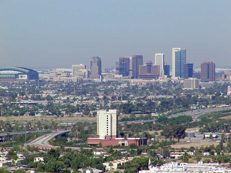
Phoenix. The Valley of the Sun. Soon to be home to my sister and her girlfriend. They’re moving at the end of the month to start the next phase of their lives together. I am sad, of course, and yet happy for them on this exciting adventure. I am no expert in Phoenix, having only visited the city once, but as an urban planner, I am adept at researching city data. So, here I present some interesting facts and observations about Phoenix from a planning perspective.

It’s Big!

Phoenix’s population is 1.469 million people. The city alone accounts for 22% of the State of Arizona’s population, making it the primate city in the state. It’s the 6th most populous city, behind New York, Los Angeles, Chicago, Houston and Philadelphia. It’s metropolitan area is home to two-thirds of all Arizonans. It’s footprint is gigantic as well. Lying in the Salt River Valley of the Sonoran Desert, Phoenix spreads out over 516 miles, more than twice the land area of Chicago. And for all that land, it’s not particularly dense, with only 2,800 people per square mile, or about a quarter of Chicago’s population per square mile. This kind of density is hard to support transit, but you might be surprised that one of the newest and most successful light rail lines was built in the city recently (more on that below).

Getting Around

Given the size of the urban area and the character of its urbanism (suburbanism), a car is essential for reasonable travel. Unfortunately, your visitors will be arriving via plane, as the last passenger rail service was suspended in 1996. Phoenix is the largest city without intercity passenger train service. However, visitors landing at Sky Harbor International Airport have the option of taking the train. The Metro light rail system, a 20 mile single line system serving 28 stations, opened in 2008. The line serves central Phoenix, Tempe and Mesa. Back to being big – Mesa, at almost 440,000 people, is the second largest suburb in the U.S., ranking above many major cities like Miami, Atlanta, and St. Louis.

Sky Harbor is the main Phoenix airport and has a Southwest hub, very important for travel back to Chicago. It’s the 10th busiest in terms of passenger traffic.

Roads are plentiful. The main interstates are 10 and 17. I-17 will take you to Sedona in 2 hours, Flagstaff in 2 and a half. I-10 will take you to L.A. in 7 hours or so. As a Chicagoan, I was struck by the size of the arterial roads in the Phoenix area. Six lanes with a double left turn lane are common. It’s no wonder everyone drives.

Similarities to Chicago

Not many as you might expect. But the obvious ones are sports related. The Chicago Cubs have the spring training home in Mesa, attracting a lot of Chicagoans to visit and retire. Also, not to be forgotten, is the fact that the Arizona Cardinals used to be the Chicago Cardinals until 1960. I also think Phoenix’s dominance as Arizona’s primate city and capital is somewhat similar to Chicago. And the prevalance of the cardinal direction street grid is familiar to Chicagoans.


Like all cities, Phoenix is fascinating and has an interesting story. From my perspective as an urban planner, particularly in the transportation realm, I am fascinated by the urban form of the region, how transportation or natural (or political) boundaries enforce the geography of a place. Phoenix has more stories to tell.

Cross posted at Ryan J. Richter.

Powered by WordPress & Theme by Anders Norén